Posts

Day 14: It's a Wrap

Image
The stats are in for the 2019 Prefrontal Tour. Distance traveled: 6085 miles Farthest day: 820 miles - 738 by bike, 82 by ferry Longest day: 16 hours Elevation covered: 350,069 feet Most elevation in a day: 93,240 feet! Top speed: 101 mph (again) Top average speed: 69 mph (because Iowa) Bacon references made: 1 (in the bonus footage) What a fantastic ride, with great scenery - so much you can't swivel your head safely to soak it all in - and an opportunity to spend time with people I admire. Planning is already underway for the next big adventure, and the destination might just be to uncovered territory in the southeast, or the northwest, or South America...  Will it be 2020, or perhaps there's room for a 2019 Version 2.0?  Only time will tell. Thanks for following along with us.  Now grab some handlebars and stay tuned!
Day 13: End to End

Image
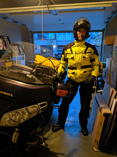
Day 13 of the 2019 Prefrontal Tour was a day of happy endings and sad goodbyes.  It came all too soon after the best evening of the tour - dinner with Jack and Donna at their home in Delafield, Wisconsin, with great fare and time spent together, and a rare opportunity to feed their wild turkeys and learn the finer points of pullet husbandry. The Fast Ferry begins its day from Milwaukee at 6:00 AM, which meant rising at 3:30 to pack, load and get on the road by 4:45, at a cold but dry 45 degrees.  Jack was kind enough to get up and prepare coffee and we reminisced about the trip and planted the seeds for the next one, hopefully somewhere near the Blue Ridge Parkway we hear so much about. I rolled down the driveway with a touch of sadness at going solo again, and turned left, prepared to take the quiet country lanes through Delafield and onto the slab to Milwaukee.  Sunrise was little more than a rose-colored promise on the eastern horizon, and I dodged the first deer ...

Day 12: Sweet Dreams

We left Nebraska to the roar of classic cars at 7:15 AM, a temperature of 57 degrees that seemed colder than it was, and a low sun rising over a flat horizon with no mountains to give us an intermittent reprieve. As luck would have it, the parade of classic cars was set to depart from our hotel, and we scrambled to insert ourselves into the line not once but twice as we jockeyed to get gassed up and on the road amidst the endless line of Chevelles, Camaros, Scooby Doo-themed Astrovans and wood-sided station wagons. We'd played ready golf two days prior and our fairway shot to Kearney was a safe lay-up that left us a long fairway wood to the green in the form of I-80 across much of the remaining distance - 665 miles to Delafield. With the heated grips set on "LIGHT TOAST" we made excellent time thanks to Nebraska's 80 mph speed limit, and we entered Iowa at 10 AM to an immediate wake-up call through the handlebars - potholes a fixed cat couldn't fill and win...

Day 11: Backtrack, backtrack...

We shot out of Salida at 6:50 AM, to 46 degrees, saluting the sun a bit as it rose low over the eastern hills - something it would do dozens of times as the canyon walls rose and fell around us.  It was a beautiful way to say goodbye to the mountains, with the Arkansas River's pools and rifflings below. We came spilling out of the canyon at the alluvial fan of Parkland, still early in the day but thousands of years too late to see it formed.  Signs for Royal Gorge were along the roadside, but that's a ride Sue and I don't want to take again any time soon. We buzzed through Canon City, shops still closed, grass growing up through the cracks in the parking lot at Sears, and then by 8 AM we were on the prairie proper, leaving behind the beautiful smells of sage and mesquite and settling in for triple digits. Today was a day for backtracking due to severe weather developing northwest and southeast, the humidity forming throughout the day hot and heavy on the ground and o...

Day 10: Wee Shits

Image
Day 10 of the 2019 Prefrontal Tour is dedicated to the wee shits... The storm we dodged hung there all night, pummeling that pass like an angry troll daring us to cross the bridge again.  By morning it was gone and we could see all of the mountains, although as usual it's sometimes hard to tell where the snowy mountains end and the clouds begin. We left Montrose and passed through the beautiful town of Delta, with its orchards and vineyards, and of course a marijuana dispensary with a creative name, this time the "Delta Dab and Doobie". Probably because of the orchards and all of the blossoms I noticed an uptick in the bugs hitting the windshield, mostly bees.  Snoopy 2 has seen more insect impacts than her namesake, but to her credit she's carrying far fewer dump duck droppings.  After all this time and miles, sad to say, I still haven't seen more than a couple of butterflies. It's no secret that dad drove so slow the bugs splattered on the back wind...

Day 9: Fade to Black

Image
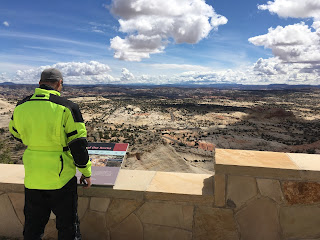
If snow is white, I wondered, how can it be so black?... We started out the day with a drive through- and a few hikes within- Arches National Park, a cool stop just outside of Moab, Utah.  Arches NP is apparently where God spat his bubble gum when he was done with it - a profusion of pink swirly blobs down low and the most amazing spires, balancing rocks, and of course arches up above.  Our first stop in the park was a giant balancing rock which I wryly commented was so aptly named by our governmental park overlords - "Balancing Rock". It was clear we weren't going to need the heavy artillery today, so we stripped out the thermal liners and switched to the warm weather gloves, also opening all of the vents in the jackets and pants. We left Moab and headed back to Colorado, hitting even more awesome roads and straightening out on Colorado 90 through what must have inspired the TV show "Big Valley".  I've never seen such a thing. It was apparent from ...

Day 8: Note to Self

Image
"Note to self"... On the 2018 Prefrontal Tour I'd say that 20 times per day, or every time I saw something I wanted to remember for my daily update.  But now thanks to Google and their ever-shifting landscape of features and products, I have to say "Add to my shopping list", and hope that Google actually transcribes my voice and stores it away.  The success rate has been between 10 and 80 percent, depending on cellular service. As you can tell from the varied list of topics I cover, (and some of the more interesting topics that don't make the update), whoever at Google and the NSA is assigned to monitor my account is probably wondering what the hell I'm up to.  Today, for instance, I added yaks and llamas to the list of large mammals we've seen, and in that vein I created a quiz for the 2019 Prefrontal Tour (no search engines allowed)... What species is the DEER XING sign, most likely? How many points on the rack of the 2D deer? BONUS: Why i...

Day 7: It's a Big, Big World

Image
It's a big, big world.  But in some places, the world is just,... bigger. After yesterday's hard-won 100 miles (the hardest yet on the 2019 Prefrontal Tour), we needed a day to get our mojo back.  We left Cortez after a heavy rain passed in the night, the tops of its mesas hidden in low-lying clouds, and turned west for Kanab, Utah. In 325 miles we had a lot to do and see, and we needed to traverse the rest of Colorado, parts of Arizona, and a handful of Utah.  Off the cuff, if Colorado is marked by elk and bison jerky, then Arizona and Utah are Indian jewelry and millenials sitting on the yellow line getting a righteous selfie.  Jack and I stopped and got a selfie of ourselves just for good measure, and to document their untimely deaths if necessary.  We're helpful like that. We went through Page (the home of Lake Powell and that iconic riverbend photo), and rode amazed through Monument Park and the Valley of the Gods - all variegated red mesas and peaks...

Day 6: Messages From the Universe

Image
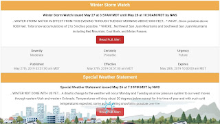
It was at that exact moment, at about 10:00 AM on the morning of Day 6 of the 2019 Prefrontal Tour that the universe decided to send me a message.  I licked a stamp and RSVP'ed "Loud and clear.  Over and out.", then pulled to the side to let a tailing truck go past and turned to descend back below the snow line... We left Ouray early, to multiple "Special Weather Statements" and "Winter Storm Warnings" above 9,000 feet, not that you could tell from the beautiful sunrise reflecting off the cliffs above.  Destination - Silverton, then Durango, and ultimately Cortez.  But we'd need to make it through Red Mountain, Molas and Coal Bank Passes first, all near or above 11,000 feet. We hit the first switchbacks literally at the end of Main Street and climbed quickly above the town, all matchbox houses and early morning shadows.  It was 34 degrees with driving snow and we had a lot of climbing to do if we were going to make it over the first pass.  Sus...

Day 5: Up and Up

Image
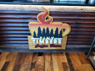
Knowing today would be a carousel of sights and smells as opposed to a marathon, we departed South Fork at a reasonable 8:30, and headed a whole half mile down the road to the Tiny Timbers Coffee Bistro for a fill-up.  Tiny Timbers was supposed to be closed today, but the gracious owners couldn't turn us away and they served up a great day-starter and some welcome advice about coming road conditions. It seems it was a record year for snowfall in the mountains and the net result is avalanche damage, boulder falls, flooding, and 100+ feet of snow still on some of the passes and roads we hoped to traverse.  Best laid plans. In the end there's so much to see that having a road or two closed matters little - we left for Creede with clear skies and little wind, turning there toward Lake City and the first significant elevation of the 2019 Prefrontal Tour, our path entwined with the Rio Grande.  We passed over the Continental Divide at about 10,900 feet, dipped momentarily ...